11. The history of accuracy in world maps.

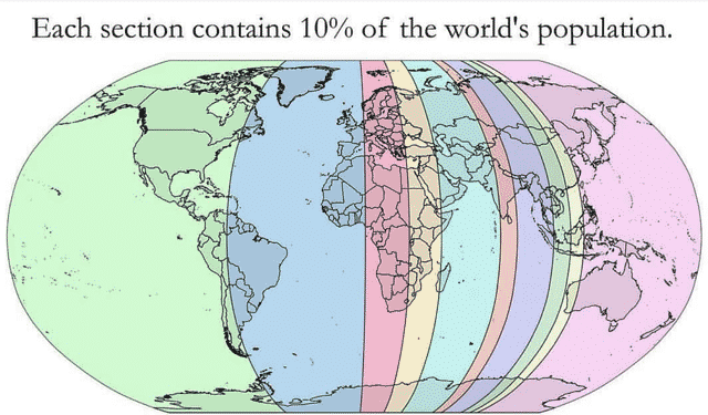
12. Each section has 10% of the world’s population.
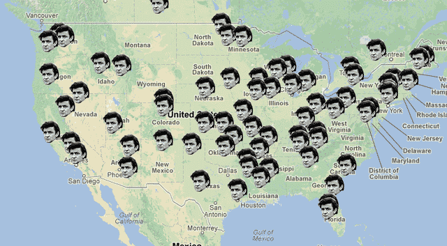
13. Locations Johnny Cash claims to have been in “Ive been everywhere.”
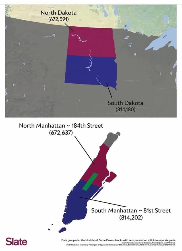
14. Comparing the population of the Dakotas and Manhattan.
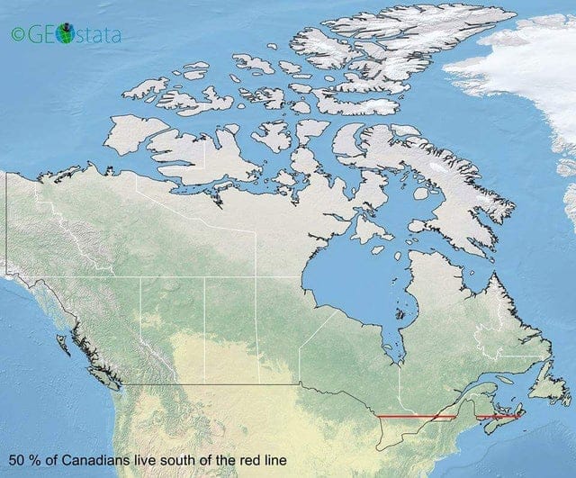
15. 50 Percent of Canadians live south of the red line.
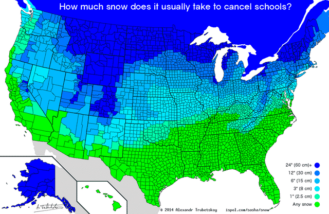
16. How much snow does it usually take to cancel schools?
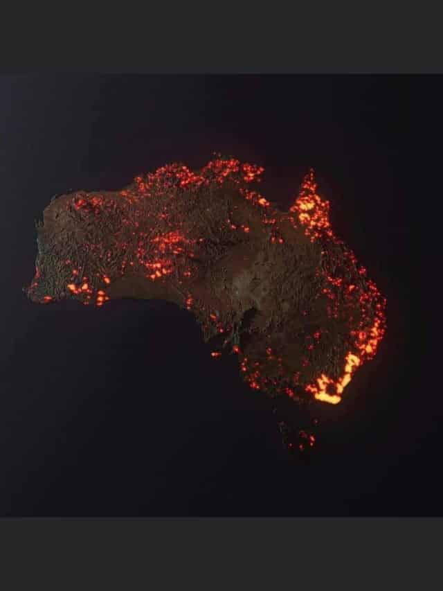
17. “3D “visualisation” of the fires in Australia, made from NASA satellite data. These are all the areas which have been affected, but not all the areas are still burning.” 📸 Credit ~ Anthony Hearsey – Creative Imaging
18.
The US numbered highway system in numerical order [GIF] [OC] from r/MapPorn
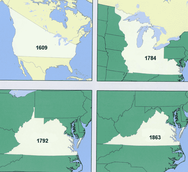
19. Virginia’s territorial claims over the years.
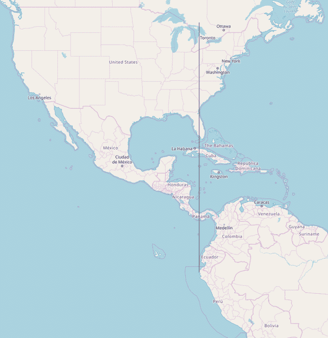
20. The entirety of continental South America lies east of Michigan.
